Tre Donne is situated in an area with a rich and interesting history. Surrounding our estate are the Hottentots Holland mountains, forming a formidable barrier between the Cape Town area and the so-called Overberg (literally: over the mountain) region. From Tre Donne you can see both the old Gantouw pass, as Sir Lowry’s Pass that succeeded it.
Yet, these are far from being the only captivating sights to behold. Turning your gaze in the opposite direction reveals the imposing silhouette of Table Mountain in the distance. When you venture to the estate’s higher parts, the shimmering expanse of False Bay becomes visible. Regularly, our evenings are adorned by the spectacle of the majestic ‘African skies’. And on many summer evenings, the mountains briefly adopt a stunning shade of orange-red.
Indigenous Khoikhoi herders used a passage over the mountains, presumably following a track created by the eland, Africa’s largest antelope. Hence the name T’kana Ouwe (transliterated to ‘Gantouw’), or Eland’s pass. Later, when the area became known as Hottentots Holland, the pass was referred to as the Hottentots Holland Kloof.
The outspan and a tap house
At the end of the 18th century a couple of farms were established at the foot of the pass. On one of these farms, named ‘Goedeverwachting’ (Dutch for good expectation(s)), stood an inn providing accommodation and extra teams of oxen to travellers crossing the kloof. In 1754 a permanent road-repairer (kloofmaker) was stationed at the foot of the mountain. On the land north of the farm Goedeverwachting, between the lower and the upper railway lines, a ruin can be found that is commonly known as the ‘old Toll house / ou Tolhuis’.
For nearly 150 years the Hottentots Holland Kloof served as one of the few primary routes into the Dutch Cape Colony’s interior before being succeeded by Sir Lowry’s Pass in 1830.
The area where Tre Donne is now, was part of a public outspan. In the days of waggon transport an outspan was land, often near a public road, set aside for public use, on which travellers broke their journey or camped while allowing their draught-animals to rest and graze. In the early 20th century ‘our’ part of the public outspan became the farm Gardenia. This piece of land was divided in two parts of 45 morgen (38,5 hectares) each.
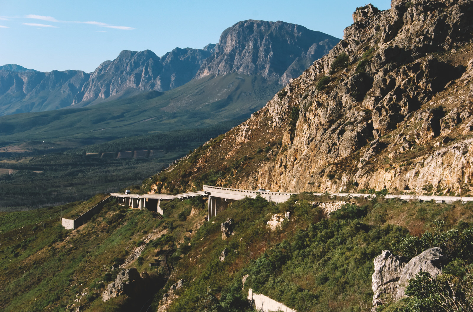
The new Sir Lowry’s Pass
Sir Galbraith Lowry Cole, Governor of the Cape Colony from 1828-1833, saw that a lack of good roads was hindering the development of the colony. Cole asked the newly appointed Surveyor-General Colonel Charles Michell to advise on the feasibility of its improvement. Michell inspected the old Kloof and advised against any repair, instead he drew up a plan for a completely new road with easy gradients, suitable for horse-drawn traffic, to the south of old Kloof. Michell set to work using 50 soldiers, 10 sappers & miners (from the Royal Engineers and the 72nd Highlanders regiment under charge of the 23-year-old Thomas Henry Duthie) and 40 convicts. On 6 July 1830 the new pass was officially opened and named Sir Lowry Cole’s Pass. Later the name was shortened to Sir Lowry’s Pass.
Old Sir Lowry’s Pass road, that now terminates at the railway line near the entrance of High Riding, was constructed in 1830 and used to continue up to the new pass, before it was eventually replaced by the N2.
The mission station
In 1816, the Reverend Barnabas Shaw of the Wesleyan Methodist Missionary Society arrived, boldly preaching without the Governor’s permission. On 1 December 1834 formal slavery was abolished in the Cape Colony. In 1847 a certain Captain Terrington gave a piece of land on his farm Myrtle Grove to the Wesleyan Society and funded the building of a small chapel. Reverend Bernard Shaw opened the chapel and named it in honour of captain Terrington: Terrington Grove Chapel. A settlement for emancipated slaves was established at the so-called missionary grounds. At the end of the twentieth century this evolved into what is now known as Sir Lowry’s Pass village, growing with RDP housing projects and informal settlements.
The railway
By 1889 a branch rail line of the Cape Government Railways had been extended to Somerset West and five months later the final section with the terminus at Sir Lowry’s Pass was opened. The first train arrived on 1 February 1890. Farmers from the Overberg brought their produce to the railway and passengers transferred to carriages to visit the warm baths of Caledon. Between the station and what is now Tre Donne, a small village, consisting of 17 plots, was established in 1889. The Hottentots-Holland mountains were a significant obstacle to any further development of the rail line and construction of the Overberg Branch Line over Sir Lowry’s Pass only started in 1899. The Anglo-Boer War slowed progress, but by 1902 the line to Caledon was opened.
In essence, Tre Donne and Sir Lowry’s Pass offer a remarkable journey through the annals of history, woven through with a thread of rich and diverse heritage. As you wander through the rolling landscapes of the estates surroundings today, you walk in the steps of travellers from the past. This treasure trove of history, combined with the breathtaking natural beauty that abounds, make this place a true chronicle of time, etched in stone and steeped in the colours of Africa.
Post articulation credit: Rob Canter